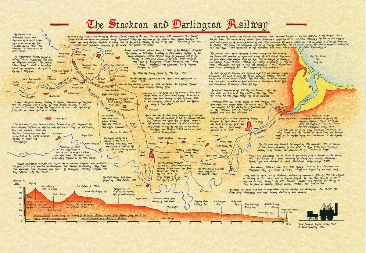
A3 map of the Stockton & Darlington Railway by Bob Hattersley
£9.00
Digital print from a limited edition hand drawn map researched and created by the late Bob Hatterlsey (1949-2010). The map is printed on to high quality art paper at A3. It will be posted in a triangular tube (think Toblerone!). This map has been made available by Jean Hattersley so that profits from the sale can be split between the Friends of the S&DR and her chosen kidney cancer charity.
23 in stock
These maps are beautifully drawn featuring huge amounts of detail covering the S&DR from 1825-1830. It also features a longitudinal section of the line with vertical exaggeration that makes it clear why inclines were required at the hilly west end. The map was originally produced by Bob in 1991.
You must be logged in to post a review.


Reviews
There are no reviews yet.